Upper Dolpo Trek Map: Your Complete Guide to Navigate the Himalayan Wonderland
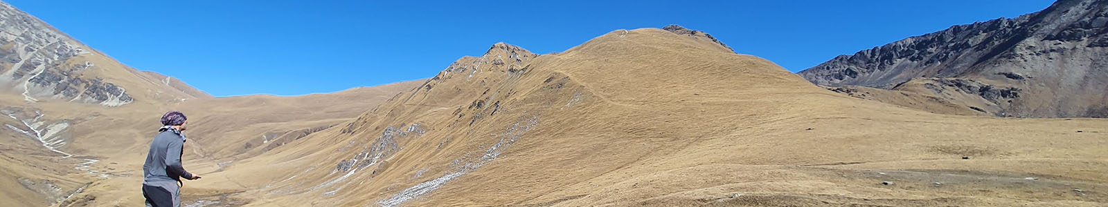
The mystical terrain of northwestern Nepal holds the pristine sanctuary of Upper Dolpo where explorers discover solitude along with cultural entertainment and thrilling outdoor adventures. The moving forward through Upper Dolpo's rough terrain needs an understanding of complete trek map information to accomplish safe navigation. This guide provides a complete breakdown of the Himalayan paradise with detailed innergration of route processes alongside challenging passes and mesmeriing architectural sights found in Upper Dolpo.
This guide serves as your ultimate resource for the Upper Dolpo Trek Map, including insights into the best upper Dolpo route map, the Upper Dolpo trek route map, and its position in the map of Nepal. Let's dive into everything you need to know to plan your expedition.
Where is Upper Dolpo on the Map of Nepal?
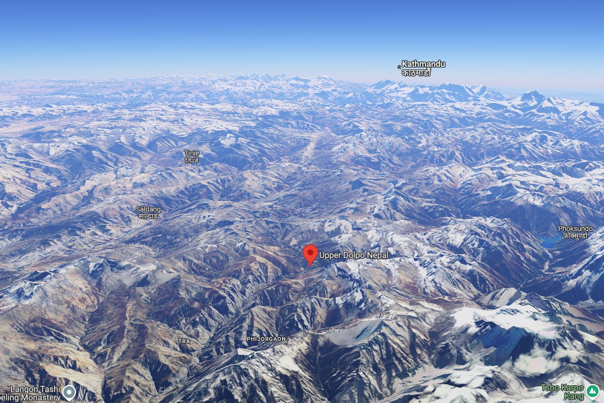
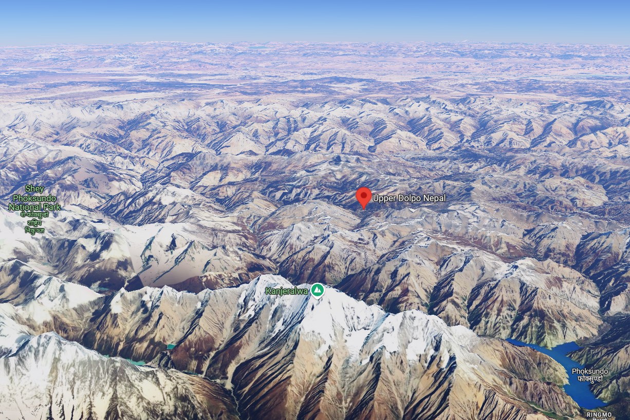
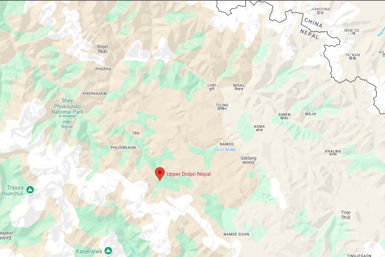
Upper Dolpo is situated in the far northwest of Nepal, bordering Tibet. It is part of Shey Phoksundo National Park, which is the country's largest trans-Himalayan national park. Typical features of Upper Dolpo are its stark and arid landscapes, turquoise-colored lakes that strike the eye, and age-old Buddhist culture. Due to a lack of accessibility and infrastructure, Upper Dolpo is one of the least explored trekking areas in Nepal, keeping its authenticity and allure intact.
Key Coordinates:
Latitude: 29.3797° N
Longitude: 83.1223° E
On the map of Nepal, Upper Dolpo is situated above Lower Dolpo, beyond the Dhaulagiri range. Its isolation makes it an off-the-beaten-path adventure.
Importance of the Upper Dolpo Trek Map
Travelers find Upper Dolpo trek planning simpler because the route map shows major locations and shows locations of mountain passes and specified camping areas. Formats that show specific navigation information defend safety while increasing performance because they show users how to proceed along dangerous slopes and unpredictable mountain regions.
A well-planned route allows you to:
- Identify significant waypoints like Shey Gompa, Phoksundo Lake, and Numala Pass.
- Strategize acclimatization points.
- Locate water sources and villages for rest.
- Avoid unnecessary detours in this challenging region.
Popular Routes on the Upper Dolpo Trek Map
While there are multiple routes to explore Upper Dolpo, most treks range between 18–27 days. Below are the most common routes with their highlights:
1. Classic Upper Dolpo Trek Route
- Duration: 25–27 days
- Route Highlights:
- Begins in Juphal (accessible via flight from Nepalgunj).
- Key stops include Dunai, Ringmo, Shey Gompa, Saldang, and Jomsom.
- Passes through Numala Pass (5,310m) and Bagala Pass (5,190m).
- Ends at Jomsom, a popular gateway in the Annapurna region.
- Who It’s For: Experienced trekkers seeking a comprehensive exploration of Upper Dolpo.
2. Phoksundo Lake & Shey Gompa Circuit
- Duration: 18–21 days
- Route Highlights:
- Ideal for trekkers focusing on cultural and natural landmarks.
- Centers around Phoksundo Lake (Nepal’s deepest lake) and the sacred Shey Gompa Monastery.
- Less strenuous than the classic route.
- Who It’s For: Trekkers looking for a moderate challenge with cultural immersion.
3. Custom Shortened Routes
- Duration: 12–15 days
- Route Highlights:
- Focuses on specific sections like Dunai to Shey Gompa and back.
- Great for trekkers with limited time.
- Who It’s For: Adventurers unable to commit to the full circuit but still eager to experience Upper Dolpo.
Major Landmarks on the Upper Dolpo Trek Map
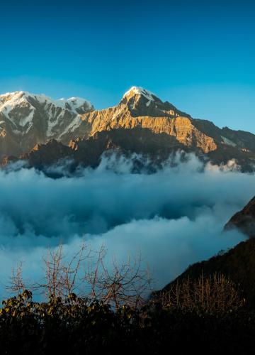
A. Phoksundo Lake
This turquoise gem is a must-see on the Dolpo trek route map. Located at 3,611 meters, its crystal-clear waters reflect the surrounding snow-capped peaks, offering an unparalleled sight.
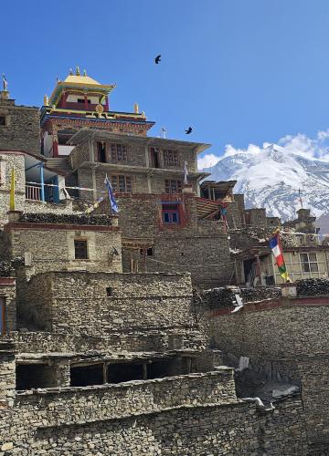
B. Shey Gompa
Known as the “Crystal Monastery,” Shey Gompa is a spiritual highlight of the region. It is a revered pilgrimage site for Buddhists and Bon practitioners.
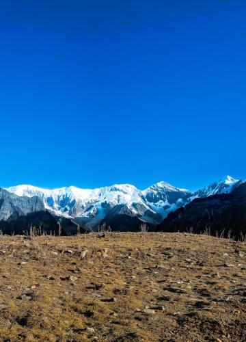
C. Saldang Village
One of the largest villages in Upper Dolpo, Saldang is a cultural treasure trove with traditional Tibetan-style homes, yak caravans, and terraced fields.
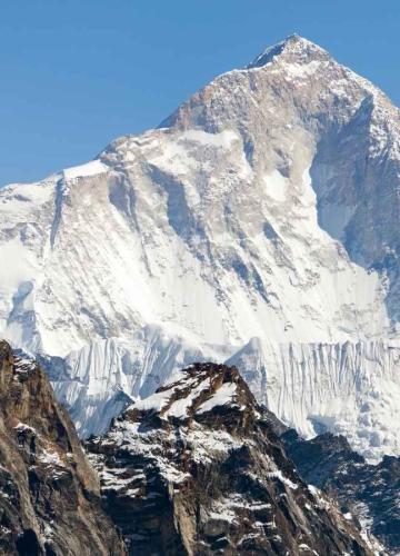
D. High Passes
- Numala Pass (5,310m): Offers panoramic views of the Dhaulagiri range.
- Bagala Pass (5,190m): A challenging ascent that rewards trekkers with breathtaking vistas.
How difficult is Upper Dolpo trek (Must Read)
Challenges of Trekking in Upper Dolpo
Upper Dolpo imposes trekking requirements that test all hikers' strength. Here's what you should consider:
- High Altitude: Almost all sections from the journey rise above 5,000 meters altitude which demands proper altitude adjustment practices.
- Remoteness: Few modern conveniences require trekkers to bring their own supplies with them throughout the journey.
- Permit Costs: The region requires multiple permits, including a Restricted Area Permit (approx. $500 for 10 days).
The Best Time to Trek
- Spring (April–June): Ideal weather with clear skies and blooming rhododendrons. For more detailed view, click here.
- Autumn (September–November): Crisp weather and vibrant landscapes.
- Avoid monsoon (July–August) due to slippery trails and winter (December–February) because of extreme cold and heavy snow.
Essentials for Navigating the Upper Dolpo Trek Map
A. Physical Map or Digital GPS: Always carry a detailed Dolpo trek route map, such as the ones available from Nepali trekking agencies or apps like Gaia GPS.
B. Knowledgeable Guide: Hiring an experienced guide ensures safe navigation through the region’s rugged trails and high passes.
C. Acclimatization Schedule: Include rest days at key stops like Ringmo or Shey Gompa to adjust to the altitude.
Upper Dolpo in Map of Nepal: A Guide to Locating Nepal’s Remote Gem
When you think of trekking in Nepal, regions like Everest and Annapurna often steal the spotlight. But for those craving untouched wilderness, cultural depth, and off-the-beaten-path adventure, Upper Dolpo in the map of Nepal is a treasure waiting to be explored. Its remote location and unique geography make it a must-visit for avid trekkers.
In this section, we’ll uncover where Upper Dolpo lies in the map of Nepal, its geographical significance, and why understanding the Upper Dolpo trek map is crucial for planning your journey.
Upper Dolpo in Map of Nepal: A Remote Himalayan Sanctuary
Upper Dolpo is tucked into the northwest corner of Nepal, bordering the Tibetan Plateau. As part of the Shey Phoksundo National Park, it is home to pristine alpine landscapes, ancient Tibetan Buddhist culture, and unparalleled solitude.
When looking at the map of Nepal, you’ll find Upper Dolpo located above the Dhaulagiri mountain range, northeast of the city of Nepalgunj, and south of the Chinese (Tibetan) border. Its position in one of the least-developed regions of Nepal has helped preserve its authenticity and natural beauty, making it a standout trekking destination.
Nepal Dolpo in Map: A Trekking Paradise
On any Nepal Dolpo in map representation, Dolpo is divided into two primary sections: Lower Dolpo and Upper Dolpo. Remote trekking allure emanates from Upper Dolpo yet Lower Dolpo accessibility remains more practical.
Key Highlights of Dolpo in the Map of Nepal:
- Shey Phoksundo Lake: Marked as one of Nepal’s deepest and most beautiful lakes, it’s a prominent feature on the map of Dolpo.
- High Passes: Passes like Numala and Bagala are essential landmarks on the Upper Dolpo trek map, showcasing the region’s rugged beauty.
- Villages: Remote villages like Saldang and Dho Tarap are cultural hotspots that show Dolpo's Tibetan heritage.
Where is Upper Dolpo in Map of Nepal?
If you’re wondering where is Upper Dolpo in the map of Nepal, the answer lies in its striking geographic placement. Upper Dolpo is a high-altitude plateau located in the Karnali Province, to the north of Nepalgunj and west of the Annapurna region.
Here are some key points to help you locate it on the map:
- Closest City Access: Nepalgunj is the nearest major city, with flights available to Juphal, the starting point for most treks.
- National Park: Upper Dolpo lies within the Shey Phoksundo National Park, Nepal’s largest national park.
- Tibetan Influence: The region borders Tibet, and its culture, language, and traditions reflect this proximity.
If you check Google Maps, search for "Upper Dolpo trek route" or "Phoksundo Lake," and you’ll find the region’s approximate location in northwestern Nepal.
Why Understanding the Upper Dolpo Trek Map Matters
Planning a trek in Upper Dolpo isn’t like organizing a trip to popular trails such as Everest Base Camp. The Upper Dolpo trek map becomes a lifeline for understanding:
- The terrain: The journey through Upper Dolpo demands climbers to complete steep hiking challenges and traverse remote passes between few settled areas.
- Cultural landmarks: To explore the cultural depth of this region you can use the maps that highlight important sites including Shey Gompa and Dho Tarap.
- Safety: In such remote terrain, having a map ensures you stick to established routes, especially in areas with limited cell service.
Check out Manaslu Mountain in the Map of Nepal on Google Maps: Click Here to View Manaslu on Google Maps
Conclusion
The present guide demonstrates to you the proper position of Upper Dolpo on the Nepal map as well as presenting its distinctive elements. The Upper Dolpo trek map provides more than navigational assistance because it unlocks your access to discover one of Earth's least-visited trekking regions.
Whether you’re captivated by the raw beauty of Shey Phoksundo Lake, the spiritual allure of Shey Gompa, or the thrill of navigating rugged high-altitude passes, Upper Dolpo offers an unparalleled adventure. Its serene isolation and breathtaking landscapes create a remote paradise that feels like stepping into another world.
The path to an unmissable trek requires preparing ahead with expert guides and following a precise Upper Dolpo trek route map while preparing for trekking at high elevations. After you've packed your proper trekking footwear head toward this Himalayan secret to begin an unforgettable journey.

Leave Your Comment